
“If this is how things go, fishermen won’t be threatened by the waves, but will die because of the reclamation. The sea will be filled in.” (Fisherman from Tugu District, 2025)
The quote above was spoken by a fisherman in Tugu District, on the western coast of Semarang City, during a focus group discussion (FGD) jointly organised by FKUB (Fisheries Groups) in West Semarang and Amerta Air Indonesia on 7 December 2025. That day marked the first time the 38-year-old fisherman had knowed that Semarang City Government was planning to do reclamation of 797 hectares of Semarang’s northern coastline.
He was shocked to see the land reclamation plans set out in the Semarang City Regional Spatial Plan (RTRW) as set out in Local Regulation No. 5/2021, which is reinforced by the Tugu District Detailed Spatial Plan (RDTR) as set out in Semarang Mayor’s Regulation No. 2/2024. These documents specify 516 hectares—part of the total Semarang coastal reclamation project—located on Tugu beach. For him, this poses a potential threat to his family’s livelihood. How could it not? The very spot where he catching the fish every day is set to be filled in with soil.
The fisherman who made the above quote is just one of the fishermen from Tugu. At that FGD, he was joined by 19 other fishermen representing the FKUB of western Semarang. According to the Semarang City Fisheries and Marine Affairs Department in 2024, the total number of fishermen in Semarang City stood at 1,068, covering both the western and eastern coasts. In Tugu itself, there are 282 fishermen who support their families by catching a variety of fish, prawns, crabs and shellfish.
The transformation of around 41 per cent of Tugu’s land area into water as a result of coastal erosion or abrasion has led to an increase in the number of local fishermen. Some fishpond farmers and fishpond workers whose working areas have been submerged have adapted by becoming fishermen, farming using the ‘rumpon’ system (involving bamboo stakes driven into the water), and/or nets as a substitute for pond embankments, as well as planting mangroves.
If we do a closer examination, the land reclamation project that dominates the western coast of Semarang is linked to the giant sea wall project on the north coast of Java. Let us begin with a statement made by President Prabowo Subianto in June 2025, which was published on the website of the Coordinating Ministry for Infrastructure and Regional Development.
Citing the government’s commitment to protecting the coastline from the threats of the climate crisis, President Prabowo outlined plans for a 500-kilometre-long giant sea wall stretching from the provinces of Banten, West Java, Central Java, to East Java. Several kilometres of this stretch run along the northern coast of Semarang in Central Java Province.
In fact, this project has been in the planning stages since 1995. In that broadcast, President Prabowo also stated, “… there will be no further delays. We will begin.” This is no small matter; the estimated investment for the project stands at USD 80 billion.
A month later, the Vice Governor of Central Java, Taj Yasin, signed a memorandum of understanding on coastal management with the Batang Regency Government, the Semarang City Government, the Ministry of Maritime Affairs and Fisheries, and PT Danareksa (Persero). As stated on the Central Java Provincial Government’s website, the coastal areas to be developed are those within the Industropolis Batang Special Economic Zone (SEZ) and the Wijayakusuma Industrial Estate (KIW) in Semarang.
According to Taj Yasin, this project, with an investment value of Rp 114 trillion (approximately USD 6.79 billion), forms part of the National Strategic Project (PSN). The KIW will be integrated with a giant seawall and the Semarang–Kendal toll road access to ensure the smooth flow of logistics along the north coast of Java. At the Borobudur Hotel in Jakarta, during the signing of the memorandum of understanding, Taj Yasin said:
“This will greatly support the future economic growth of Central Java. Marine Spatial Planning for the Blue Economy Towards a Golden Indonesia.”
Next, let’s to look at a statement made by the Mayor of Semarang two years earlier, when the giant sea wall was still locked away in the ‘box of plan’. In May 2023, in the presence of the Director-General of Spatial Planning at the Ministry of Agrarian and Spatial Planning/National Land Agency (ATR/BPN), Hevearita Gunaryanti Rahayu, the then Mayor of Semarang outlined plans to develop the Tugu District as a new investment zone and an international-scale centre for trade and services.
As if she had prepared a ‘container’ in case the ‘box of plan’ were ever opened, Hevearita highlighted the alignment of Tugu District’s development with Semarang’s Regional Spatial Plan (RTRW), underpinned by the Tugu District Detailed Spatial Plan (RDTR) for 2023–2043. Remarkably, this Tugu District RDTR was published earlier than those of any other District in Semarang—a derivative of the 2021 version of the RTRW—which have yet to be officially published.
Echoing the Vice Governor and the President, who have been championing investment, Hevearita is working to establish a fast-track process for investors in the development of the Tugu area.
“As far as investors are concerned, the process must be integrated with the OSS (One Single Submission) system, so that they can simply click and the process will be swift,” said Hevearita in front of officials from the Ministry of Agrarian and Spatial Planning/National Land Agency.
Co-Learning
Through the FGD held on 7 December 2025, the fishermen who are members of the FKUB and the researchers from Amerta Air Indonesia jointly learnt and came to understand that the adaptation measures undertaken by the residents of Tugu, including the fishermen, are disconnected from the government’s overarching adaptation strategy in addressing rising sea levels—which cause tidal flooding—as one manifestation of what they refer to as the consequences of the climate crisis.
The FGD itself—and the subsequent activities reported in this article—formed part of a series of activities organised by Amerta Air Indonesia in collaboration with the FKUB under ‘the Democratic Green Growth Innovation Lab‘, supported by the Westminster Foundation for Democracy (WFD). As it was intended to serve as the space of learning together, the FGD was referred to as a ‘co-learning’.
Through ‘co-learning’, both FKUB and Amerta Air Indonesia are learning together about how to ‘democratise’ knowledge. Planning documents, which until now had been the preserve of the elite, bureaucrats, and academics acting as experts, were read together at the Tugu Community Hall. Complex legal language was translated into the everyday experiences of fishermen. Similarly, the everyday experiences of residents were recorded and captured as knowledge on a par with that set out in the planning documents.
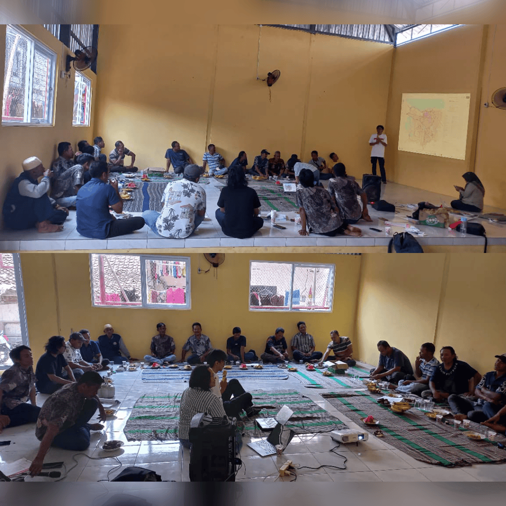
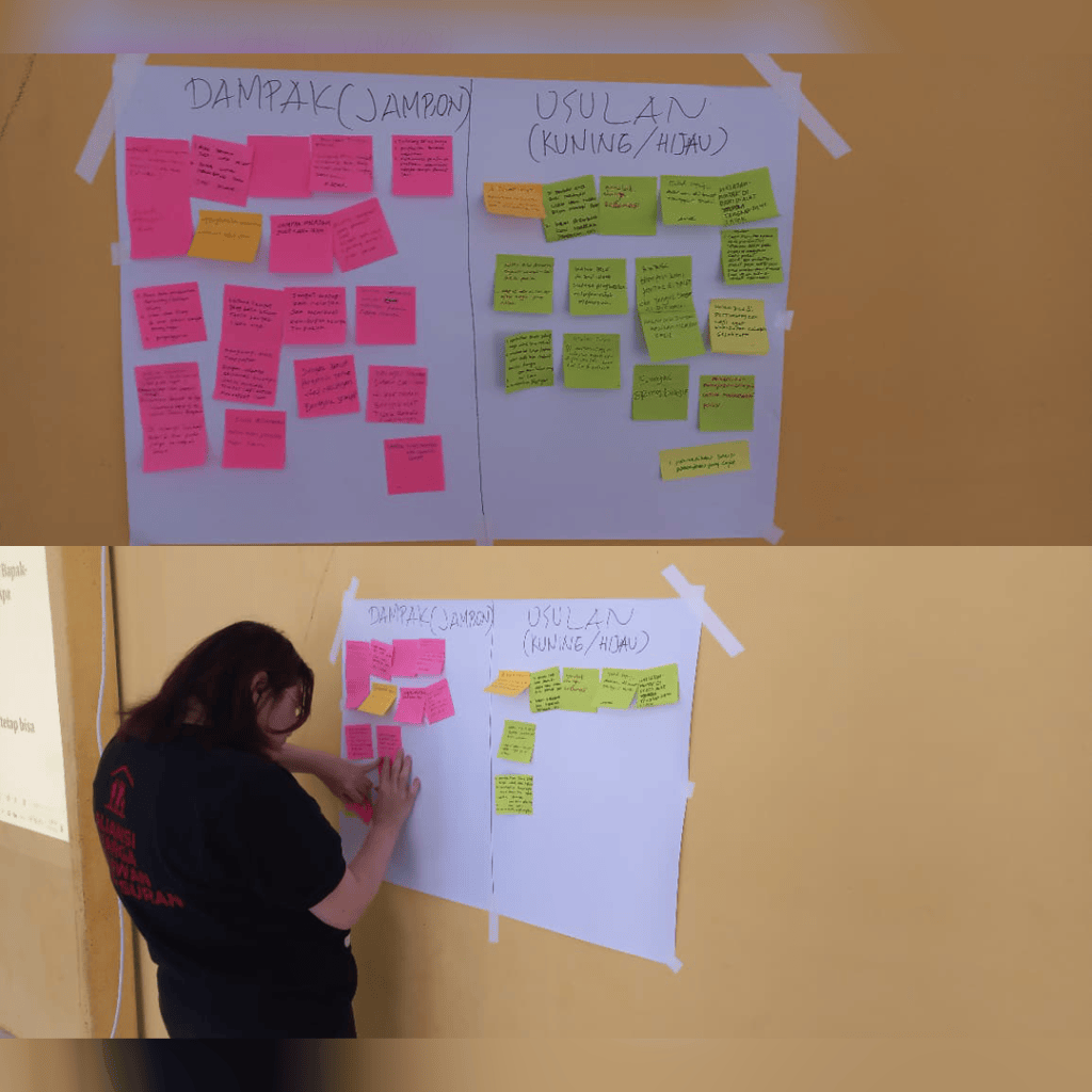
According to fishermen from the FKUB, the sea—which is the source of their families’ livelihoods—was once dry land used for fish ponds. Rising sea levels, combined with land subsidence, have exacerbated tidal flooding (where rising sea water floods the land), leading to coastal erosion or abrasion that has submerged the fish pond areas. This is consistent with a 2013 report by Republika, which cited data from the Semarang City Marine and Fisheries Department regarding coastal erosion in Tugu, which submerged 41.43 per cent of the Tugu area (1,211.20 hectares out of 2,923.34 hectares).
Furthermore, research by the Institute Pertanian Bogor published in the Journal of Science and Technology and in a book entitled Semarang Lemahe Ambles: Membangun Pengetahuan Sosial dari Pengalaman Sehari-hari Warga tentang Amblesan Tanah di Pesisir Semarang (2025) states that the rate of coastal erosion or abrasion in Tugu up to 2041 ranges from 0.05 to 24.37 metres per year.
Through these FGD (Co-Learning) sessions, the FKUB, together with Amerta Air Indonesia, identified the potential impacts that would arise if the reclamation plan were to be implemented north of Tugu. These include (1) the blocking of access to the sea; (2) damage to the marine ecosystem; (3) a decline in residents’ incomes, particularly among fishermen; and (4) rising unemployment. In addition to the potential impacts, the FKUB and Amerta Air Indonesia also identified initiatives drawn from local knowledge regarding the adaptation strategies employed by local residents.
First, preserving and expanding mangrove areas, which serve as fish spawning grounds and protect the coastline from ongoing erosion. Second, preserving fishing grounds. Third, ensuring fishermen’s access to the sea. Fourth, safeguarding the livelihoods of local residents. Fifth, involving the community or local residents in the drafting of spatial plans for the areas in which they live. Sixth, opposing land reclamation that causes adverse impacts on marine ecosystems and leads to the decline or even disappearance of fishermen’s livelihoods.
It is not only for local fishermen; the waters north of Tugu also provide a livelihood for fishermen from other regions. These include fishermen from the eastern coast of Semarang, as well as from other parts of the Central Java coast: Demak, Jepara, and Kendal regencies. To put it into perspective, the area of the planned land reclamation north of Tugu, as outlined above, is equivalent to 700 football pitches. Consequently, the potential adverse impacts will not only affect the families of Tugu’s fishermen, but also other fishermen who catch seafood in the waters around Tugu.
Co-Creation
Building on this situation, the conclusions drawn from the FGD-Co-Learning sessions were brought to a wider discussion forum. On 4 February 2026, the FKUB and Amerta Air Indonesia partnered with activists from the Semarang-Demak Poor People’s Alliance (ARMSD), comprising largely residents of the Semarang-Demak coastal area; community organisers from the Urban Poor Consortium (UPC); community activists from Air Warga Semarang-Kendal, particularly those living in Tugu District; researchers currently conducting ethnographic research in Tugu District; and academics specialising in law and urban planning from Universitas Katolik Soegijapranata, Universitas Islam Sultan Agung, and Universitas Negeri Semarang, to hold a workshop entitled ‘Co-Creation’, with the aim of working together.
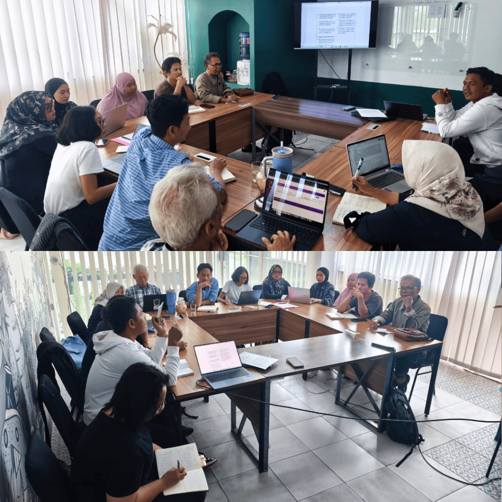
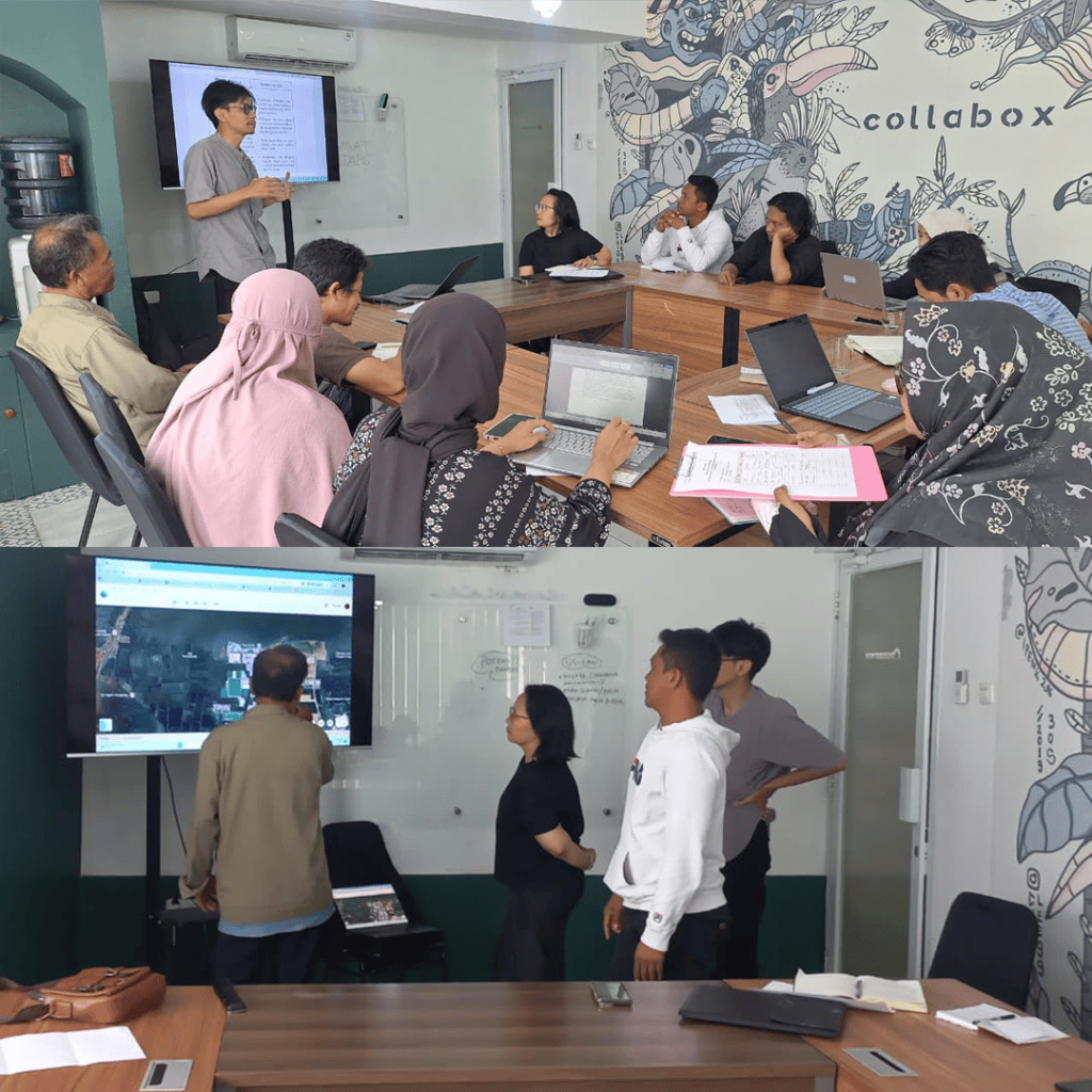
Input from the various elements outlined above was used to produce a collaborative document in the form of a policy brief.
Firstly, this concerns the identification of principles that have been overlooked and the forms of neglect in the drafting and adoption of spatial planning schemes, specifically regarding Tugu District and, more generally, the coastal areas of Semarang City (further details on this are set out in the policy brief). These include the principles, stages and procedures for public participation in the drafting of spatial planning regulations; the principles of protection for fishermen and fish farmers; and the principles of good governance.
Secondly, regarding the identification of issues that threaten fishermen’s livelihoods as a result of land reclamation, such as the potential blocking of five rivers in Tugu District that are used for fishing, the potential loss of marine reproductive ecosystems, and the lack of economic security for local residents.
In this process, the drafting was not carried out by Amerta Air Indonesia researchers, other researchers currently conducting research in Tugu, or university academics. Instead, the drafting was based on key ideas that emerged from collaboration with fishermen during the co-learning activities. These key ideas can be summarised in two points.
Firstly, regarding concrete matters: the designation of community fishing zones; the equal involvement of fishermen alongside other stakeholders in the formulation of spatial planning regulations or policies; and the provision of adequate economic security.
Secondly, regarding the spatial planning policy decision-making process, which consists of evidence gathering (participatory mapping of fishing grounds, detailed data collection on fishermen’s profiles and the infrastructure used, and documentation of impacts); review of evidence (establishment of a dialogue forum involving all relevant stakeholders, particularly fishermen in this context); formal deliberation (for example: proposals for the designation of fishing zones); and implementation (public awareness campaigns on spatial planning policies and mechanisms for periodic review).
A Model and The Long Way Ahead
Within the series of activities in the Democratic Green Growth Innovation Lab, the two activities mentioned above—co-learning and co-creation—became a path forged as we went along. It was this path that was taken to move from a position of exclusion at the outset—where residents were not involved and were even at risk of losing their livelihoods—to becoming informed through the first stage: co-learning.
In the next stage—co-creation—the role of residents evolves to that of being consulted; this is not merely a formality to fulfil the formal requirements for policy-making, but a genuine dialogue to discuss interests relating to the sustainability of residents’ livelihoods. Consequently, the public consultation process typically undertaken by the government appears to fulfil the procedures for policy formulation, rather than merely serving as a process for outreach for policy plans. Instead, it is a reciprocal process, in which all parties learn from one another and gain a mutual understanding of the interests involved in sustainable livelihoods.
For the time being, as a first step, this series of initiatives—which have already been developed and implemented—was presented at the event ‘Southeast Asia’s push for democratic green growth’ in Bangkok, Thailand, on 4 March 2026, attended by other Lab members and parliamentarians from Southeast Asia (Malaysia, Thailand, Laos and Indonesia), representatives of the Inter-Parliamentary Cooperation Agency (BKSAP) of the Republic of Indonesia, and the President of the South East Asian Parliamentarians Against Corruption (SEAPAC).
However, the way ahead is not yet complete. The next steps still need to be taken to ensure the continued livelihood of fishermen. In this regard, the fishing communities need to become more involved in the process of (1) formulating solutions to the problems identified above so that they are incorporated into new policies; (2) monitoring the implementation of these policies; and (3) periodically reviewing the implementation of these policies in line with developments in the current situation.
The overall approach resulting from this process of collaborative learning and creation together has been formulated as an ‘open micro-model’ that can be utilised and developed using a contextual approach by other groups along the Semarang–Demak coastline, such as mangrove planters, fishpond farmers, and other communities situated outside the mainstream of spatial planning. Therefore, every community has the right to undergo a similar process. Not to produce identical documents, but to document their voices and find their own paths towards achieving a sustainable livelihood. (*)
Authors: Eka Handriana, Melati Yustika Widya Pratiwi, and Bagas Yusuf Kausan
 Yayasan Amerta Air Indonesia